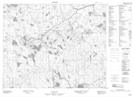
Maps showing Bujeault River, Eagle River, Newfoundland and Labrador
Bujeault River is a River located in Eagle River, Newfoundland and Labrador and has an elevation of 341 meters.
- Latitude: 51° 60' 00'' North (decimal: 51.9999999)
- Longitude: 57° 16' 42'' West (decimal: -57.2783333)
- Topography Feature Category: River
- Geographical Feature: River
- Canadian Province/Territory: Newfoundland and Labrador
- Elevation: 341 meters
- Location: Eagle River
- Atlas of Canada Locator Map: Bujeault River
- GPS Coordinate Locator Map: Bujeault River Lat/Long
Bujeault River NTS Map Sheets