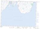
Maps showing Millers Break, Ferryland, Newfoundland and Labrador
Millers Break is a Valley located in Ferryland, Newfoundland and Labrador.
- Latitude: 46° 43' 00'' North (decimal: 46.7166666)
- Longitude: 53° 23' 57'' West (decimal: -53.3991666)
- Topography Feature Category: Valley
- Geographical Feature: Pass
- Canadian Province/Territory: Newfoundland and Labrador
- Location: Ferryland
- GPS Coordinate Locator Map: Millers Break Lat/Long
Millers Break NTS Map Sheets