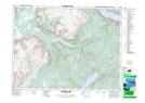
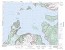
Maps showing Halfway Point-Benoit's Cove-John's Beach-Frenchman's Cove, Newfoundland and Labrador
Halfway Point-Benoit's Cove-John's Beach-Frenchman's Cove is a Town located in Newfoundland and Labrador.
- Latitude: 49° 1' 00'' North (decimal: 49.0166666)
- Longitude: 58° 8' 57'' West (decimal: -58.1491666)
- Topography Feature Category: Town
- Geographical Feature: Town
- Canadian Province/Territory: Newfoundland and Labrador
- GPS Coordinate Locator Map: Halfway Point-Benoit's Cove-John's Beach-Frenchman's Cove Lat/Long
Halfway Point-Benoit's Cove-John's Beach-Frenchman's Cove NTS Map Sheets