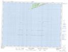
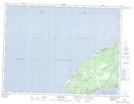
Maps showing Cape St. George-Petit Jardin-Grand Jardin-De Grau-Marches Point-Loretto, Port au Port, Newfoundland and Labrador
Cape St. George-Petit Jardin-Grand Jardin-De Grau-Marches Point-Loretto is a Town located in Port au Port, Newfoundland and Labrador.
- Latitude: 48° 29' 45'' North (decimal: 48.4957026)
- Longitude: 59° 11' 6'' West (decimal: -59.1849305)
- Topography Feature Category: Town
- Geographical Feature: Town
- Canadian Province/Territory: Newfoundland and Labrador
- Location: Port au Port
- Atlas of Canada Locator Map: Cape St. George-Petit Jardin-Grand Jardin-De Grau-Marches Point-Loretto
- GPS Coordinate Locator Map: Cape St. George-Petit Jardin-Grand Jardin-De Grau-Marches Point-Loretto Lat/Long
Cape St. George-Petit Jardin-Grand Jardin-De Grau-Marches Point-Loretto NTS Map Sheets