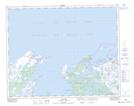
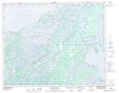
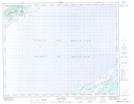
Maps showing Lead Pond, Strait of Belle Isle, Newfoundland and Labrador
Lead Pond is a Lake located in Strait of Belle Isle, Newfoundland and Labrador and has an elevation of 28 meters.
- Latitude: 51° 31' 2'' North (decimal: 51.5172222)
- Longitude: 56° 1' 36'' West (decimal: -56.0266666)
- Topography Feature Category: Lake
- Geographical Feature: Pond
- Canadian Province/Territory: Newfoundland and Labrador
- Elevation: 28 meters
- Location: Strait of Belle Isle
- Atlas of Canada Locator Map: Lead Pond
- GPS Coordinate Locator Map: Lead Pond Lat/Long
Lead Pond NTS Map Sheets