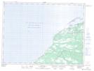
Maps showing Mistyglee Brook Point, St. George's, Newfoundland and Labrador
Mistyglee Brook Point is a Cape located in St. George's, Newfoundland and Labrador.
- Latitude: 48° 25' 1'' North (decimal: 48.4169444)
- Longitude: 58° 33' 24'' West (decimal: -58.5566666)
- Topography Feature Category: Cape
- Geographical Feature: Point
- Canadian Province/Territory: Newfoundland and Labrador
- Location: St. George's
- Atlas of Canada Locator Map: Mistyglee Brook Point
- GPS Coordinate Locator Map: Mistyglee Brook Point Lat/Long
Mistyglee Brook Point NTS Map Sheets