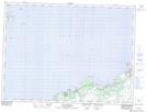
Maps showing New Chelsea-New Melbourne-Brownsdale-Sibley's Cove-Lead Cove, Newfoundland and Labrador
New Chelsea-New Melbourne-Brownsdale-Sibley's Cove-Lead Cove is a Unincorporated area located in Newfoundland and Labrador.
- Latitude: 48° 1' 39'' North (decimal: 48.0274999)
- Longitude: 53° 8' 50'' West (decimal: -53.1472222)
- Topography Feature Category: Unincorporated area
- Geographical Feature: Local Service District
- Canadian Province/Territory: Newfoundland and Labrador
- Atlas of Canada Locator Map: New Chelsea-New Melbourne-Brownsdale-Sibley's Cove-Lead Cove
- GPS Coordinate Locator Map: New Chelsea-New Melbourne-Brownsdale-Sibley's Cove-Lead Cove Lat/Long
New Chelsea-New Melbourne-Brownsdale-Sibley's Cove-Lead Cove NTS Map Sheets