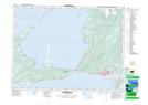
Maps showing Ship Cove-Lower Cove, Newfoundland and Labrador
Ship Cove-Lower Cove is a Unincorporated area located in Newfoundland and Labrador.
- Latitude: 48° 31' 00'' North (decimal: 48.5166666)
- Longitude: 58° 58' 57'' West (decimal: -58.9825000)
- Topography Feature Category: Unincorporated area
- Geographical Feature: Local Service District
- Canadian Province/Territory: Newfoundland and Labrador
- GPS Coordinate Locator Map: Ship Cove-Lower Cove Lat/Long
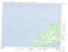
Ship Cove-Lower Cove NTS Map Sheets