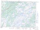
Maps showing Forest Field-New Bridge, The Capes, Newfoundland and Labrador
Forest Field-New Bridge is a Unincorporated area located in The Capes, Newfoundland and Labrador.
- Latitude: 47° 8' 58'' North (decimal: 47.1494444)
- Longitude: 53° 27' 57'' West (decimal: -53.4658333)
- Topography Feature Category: Unincorporated area
- Geographical Feature: Local Service District
- Canadian Province/Territory: Newfoundland and Labrador
- Location: The Capes
- Atlas of Canada Locator Map: Forest Field-New Bridge
- GPS Coordinate Locator Map: Forest Field-New Bridge Lat/Long
Forest Field-New Bridge NTS Map Sheets