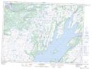
Maps showing Four Mile Pool, Placentia, Newfoundland and Labrador
Four Mile Pool is a River feature located in Placentia, Newfoundland and Labrador.
- Latitude: 47° 13' 22'' North (decimal: 47.2227777)
- Longitude: 53° 49' 35'' West (decimal: -53.8263888)
- Topography Feature Category: River feature
- Geographical Feature: Pool
- Canadian Province/Territory: Newfoundland and Labrador
- Location: Placentia
- Atlas of Canada Locator Map: Four Mile Pool
- GPS Coordinate Locator Map: Four Mile Pool Lat/Long
Four Mile Pool NTS Map Sheets