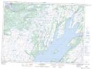
Maps showing Snack Cove Pond, Placentia, Newfoundland and Labrador
Snack Cove Pond is a Lake located in Placentia, Newfoundland and Labrador.
- Latitude: 47° 14' 58'' North (decimal: 47.2494444)
- Longitude: 53° 56' 21'' West (decimal: -53.9391666)
- Topography Feature Category: Lake
- Geographical Feature: Pond
- Canadian Province/Territory: Newfoundland and Labrador
- Location: Placentia
- Atlas of Canada Locator Map: Snack Cove Pond
- GPS Coordinate Locator Map: Snack Cove Pond Lat/Long
Snack Cove Pond NTS Map Sheets