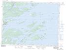
Maps showing Ballast Island, Terra Nova, Newfoundland and Labrador
Ballast Island is a Island located in Terra Nova, Newfoundland and Labrador.
- Latitude: 48° 47' 46'' North (decimal: 48.7961111)
- Longitude: 53° 38' 29'' West (decimal: -53.6413888)
- Topography Feature Category: Island
- Geographical Feature: Island
- Canadian Province/Territory: Newfoundland and Labrador
- Location: Terra Nova
- Atlas of Canada Locator Map: Ballast Island
- GPS Coordinate Locator Map: Ballast Island Lat/Long
Ballast Island NTS Map Sheets