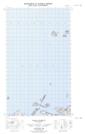
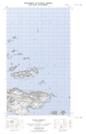
Maps showing Indian Harbour, Eagle River, Newfoundland and Labrador
Indian Harbour is a Unincorporated area located in Eagle River, Newfoundland and Labrador.
- Latitude: 53° 47' 52'' North (decimal: 53.7977926)
- Longitude: 56° 59' 43'' West (decimal: -56.9952078)
- Topography Feature Category: Unincorporated area
- Geographical Feature: Settlement
- Canadian Province/Territory: Newfoundland and Labrador
- Location: Eagle River
- Atlas of Canada Locator Map: Indian Harbour
- GPS Coordinate Locator Map: Indian Harbour Lat/Long
Indian Harbour NTS Map Sheets