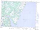
Maps showing Blue Hill, Bellevue, Newfoundland and Labrador
Blue Hill is a Mountain located in Bellevue, Newfoundland and Labrador.
- Latitude: 47° 58' 34'' North (decimal: 47.9761111)
- Longitude: 53° 43' 40'' West (decimal: -53.7277777)
- Topography Feature Category: Mountain
- Geographical Feature: Hill
- Canadian Province/Territory: Newfoundland and Labrador
- Location: Bellevue
- Atlas of Canada Locator Map: Blue Hill
- GPS Coordinate Locator Map: Blue Hill Lat/Long
Blue Hill NTS Map Sheets