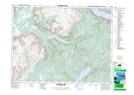
Maps showing Stag Hill, Bay of Islands, Newfoundland and Labrador
Stag Hill is a Mountain located in Bay of Islands, Newfoundland and Labrador and has an elevation of 344 meters.
- Latitude: 48° 49' 50'' North (decimal: 48.8305555)
- Longitude: 58° 6' 48'' West (decimal: -58.1133333)
- Topography Feature Category: Mountain
- Geographical Feature: Hill
- Canadian Province/Territory: Newfoundland and Labrador
- Elevation: 344 meters
- Location: Bay of Islands
- Atlas of Canada Locator Map: Stag Hill
- GPS Coordinate Locator Map: Stag Hill Lat/Long
Stag Hill NTS Map Sheets