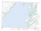
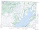
Maps showing High Marsh, St. Mary's-The Capes, Newfoundland and Labrador
High Marsh is a Low vegetation located in St. Mary's-The Capes, Newfoundland and Labrador.
- Latitude: 46° 59' 54'' North (decimal: 46.9982421)
- Longitude: 53° 41' 6'' West (decimal: -53.6849360)
- Topography Feature Category: Low vegetation
- Geographical Feature: Marsh
- Canadian Province/Territory: Newfoundland and Labrador
- Location: St. Mary's-The Capes
- Atlas of Canada Locator Map: High Marsh
- GPS Coordinate Locator Map: High Marsh Lat/Long
High Marsh NTS Map Sheets