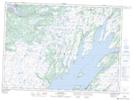
Maps showing Philips Island, Placentia, Newfoundland and Labrador
Philips Island is a Island located in Placentia, Newfoundland and Labrador.
- Latitude: 47° 13' 27'' North (decimal: 47.2241666)
- Longitude: 53° 56' 51'' West (decimal: -53.9475000)
- Topography Feature Category: Island
- Geographical Feature: Island
- Canadian Province/Territory: Newfoundland and Labrador
- Location: Placentia
- Atlas of Canada Locator Map: Philips Island
- GPS Coordinate Locator Map: Philips Island Lat/Long
Philips Island NTS Map Sheets