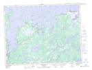
Maps showing Dormans Point, Fogo, Newfoundland and Labrador
Dormans Point is a Cape located in Fogo, Newfoundland and Labrador.
- Latitude: 49° 19' 31'' North (decimal: 49.3252777)
- Longitude: 54° 28' 48'' West (decimal: -54.4800000)
- Topography Feature Category: Cape
- Geographical Feature: Point
- Canadian Province/Territory: Newfoundland and Labrador
- Location: Fogo
- Atlas of Canada Locator Map: Dormans Point
- GPS Coordinate Locator Map: Dormans Point Lat/Long
Dormans Point NTS Map Sheets