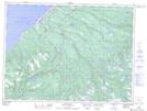
Maps showing Loch Leven, St. George's, Newfoundland and Labrador
Loch Leven is a Unincorporated area located in St. George's, Newfoundland and Labrador and has an elevation of 40 meters.
- Latitude: 48° 10' 6'' North (decimal: 48.1683333)
- Longitude: 58° 51' 50'' West (decimal: -58.8638888)
- Topography Feature Category: Unincorporated area
- Geographical Feature: Neighbourhood
- Canadian Province/Territory: Newfoundland and Labrador
- Elevation: 40 meters
- Location: St. George's
- Atlas of Canada Locator Map: Loch Leven
- GPS Coordinate Locator Map: Loch Leven Lat/Long
Loch Leven NTS Map Sheets