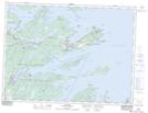
Maps showing Deer Island Pond, Terra Nova, Newfoundland and Labrador
Deer Island Pond is a Lake located in Terra Nova, Newfoundland and Labrador.
- Latitude: 48° 31' 45'' North (decimal: 48.5291666)
- Longitude: 53° 40' 17'' West (decimal: -53.6713888)
- Topography Feature Category: Lake
- Geographical Feature: Pond
- Canadian Province/Territory: Newfoundland and Labrador
- Location: Terra Nova
- Atlas of Canada Locator Map: Deer Island Pond
- GPS Coordinate Locator Map: Deer Island Pond Lat/Long