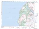
Maps showing Halfway Pond, St. Barbe, Newfoundland and Labrador
Halfway Pond is a Lake located in St. Barbe, Newfoundland and Labrador.
- Latitude: 49° 29' 35'' North (decimal: 49.4930555)
- Longitude: 58° 1' 8'' West (decimal: -58.0188888)
- Topography Feature Category: Lake
- Geographical Feature: Pond
- Canadian Province/Territory: Newfoundland and Labrador
- Location: St. Barbe
- Atlas of Canada Locator Map: Halfway Pond
- GPS Coordinate Locator Map: Halfway Pond Lat/Long
Halfway Pond NTS Map Sheets