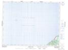
Maps showing Green Fire Cove, St. Barbe, Newfoundland and Labrador
Green Fire Cove is a Bay located in St. Barbe, Newfoundland and Labrador.
- Latitude: 49° 30' 38'' North (decimal: 49.5105555)
- Longitude: 58° 5' 58'' West (decimal: -58.0994444)
- Topography Feature Category: Bay
- Geographical Feature: Cove
- Canadian Province/Territory: Newfoundland and Labrador
- Location: St. Barbe
- Atlas of Canada Locator Map: Green Fire Cove
- GPS Coordinate Locator Map: Green Fire Cove Lat/Long
Green Fire Cove NTS Map Sheets