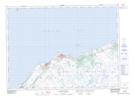
Maps showing Tom Lees Marsh, Grand Bank, Newfoundland and Labrador
Tom Lees Marsh is a Low vegetation located in Grand Bank, Newfoundland and Labrador.
- Latitude: 47° 6' 27'' North (decimal: 47.1075000)
- Longitude: 55° 37' 11'' West (decimal: -55.6197222)
- Topography Feature Category: Low vegetation
- Geographical Feature: Marsh
- Canadian Province/Territory: Newfoundland and Labrador
- Location: Grand Bank
- Atlas of Canada Locator Map: Tom Lees Marsh
- GPS Coordinate Locator Map: Tom Lees Marsh Lat/Long
Tom Lees Marsh NTS Map Sheets