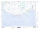
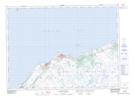
Maps showing Old Hill Marsh, Grand Bank, Newfoundland and Labrador
Old Hill Marsh is a Low vegetation located in Grand Bank, Newfoundland and Labrador.
- Latitude: 47° 0' 12'' North (decimal: 47.0033333)
- Longitude: 55° 30' 55'' West (decimal: -55.5152777)
- Topography Feature Category: Low vegetation
- Geographical Feature: Marsh
- Canadian Province/Territory: Newfoundland and Labrador
- Location: Grand Bank
- Atlas of Canada Locator Map: Old Hill Marsh
- GPS Coordinate Locator Map: Old Hill Marsh Lat/Long
Old Hill Marsh NTS Map Sheets