Maps showing Doughball Brook, Grand Bank, Newfoundland and Labrador
Doughball Brook is a River located in Grand Bank, Newfoundland and Labrador.
- Latitude: 47° 15' 13'' North (decimal: 47.2536111)
- Longitude: 55° 19' 22'' West (decimal: -55.3227777)
- Topography Feature Category: River
- Geographical Feature: Brook
- Canadian Province/Territory: Newfoundland and Labrador
- Location: Grand Bank
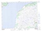
- Atlas of Canada Locator Map: Doughball Brook
- GPS Coordinate Locator Map: Doughball Brook Lat/Long
Doughball Brook NTS Map Sheets