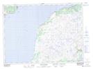
Maps showing Catgut Pond, Fortune-Hermitage, Newfoundland and Labrador
Catgut Pond is a Lake located in Fortune-Hermitage, Newfoundland and Labrador.
- Latitude: 47° 26' 57'' North (decimal: 47.4491666)
- Longitude: 55° 7' 43'' West (decimal: -55.1286111)
- Topography Feature Category: Lake
- Geographical Feature: Pond
- Canadian Province/Territory: Newfoundland and Labrador
- Location: Fortune-Hermitage
- Atlas of Canada Locator Map: Catgut Pond
- GPS Coordinate Locator Map: Catgut Pond Lat/Long
Catgut Pond NTS Map Sheets