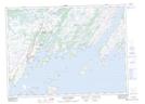
Maps showing West Long Shore Gull Pond, Fortune-Hermitage, Newfoundland and Labrador
West Long Shore Gull Pond is a Lake located in Fortune-Hermitage, Newfoundland and Labrador.
- Latitude: 47° 29' 26'' North (decimal: 47.4905555)
- Longitude: 54° 56' 53'' West (decimal: -54.9480555)
- Topography Feature Category: Lake
- Geographical Feature: Pond
- Canadian Province/Territory: Newfoundland and Labrador
- Location: Fortune-Hermitage
- Atlas of Canada Locator Map: West Long Shore Gull Pond
- GPS Coordinate Locator Map: West Long Shore Gull Pond Lat/Long
West Long Shore Gull Pond NTS Map Sheets