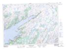
Maps showing Burn Cowhouse Point, Fortune-Hermitage, Newfoundland and Labrador
Burn Cowhouse Point is a Cape located in Fortune-Hermitage, Newfoundland and Labrador.
- Latitude: 47° 35' 6'' North (decimal: 47.5850000)
- Longitude: 54° 52' 6'' West (decimal: -54.8683333)
- Topography Feature Category: Cape
- Geographical Feature: Point
- Canadian Province/Territory: Newfoundland and Labrador
- Location: Fortune-Hermitage
- Atlas of Canada Locator Map: Burn Cowhouse Point
- GPS Coordinate Locator Map: Burn Cowhouse Point Lat/Long
Burn Cowhouse Point NTS Map Sheets