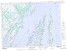
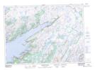
Maps showing Gates Pond, Burin-Placentia West, Newfoundland and Labrador
Gates Pond is a Lake located in Burin-Placentia West, Newfoundland and Labrador.
- Latitude: 47° 36' 51'' North (decimal: 47.6141666)
- Longitude: 54° 30' 41'' West (decimal: -54.5113888)
- Topography Feature Category: Lake
- Geographical Feature: Pond
- Canadian Province/Territory: Newfoundland and Labrador
- Location: Burin-Placentia West
- Atlas of Canada Locator Map: Gates Pond
- GPS Coordinate Locator Map: Gates Pond Lat/Long
Gates Pond NTS Map Sheets