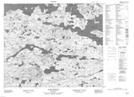
Maps showing Grassy Island, Eagle River, Newfoundland and Labrador
Grassy Island is a Island located in Eagle River, Newfoundland and Labrador.
- Latitude: 53° 40' 18'' North (decimal: 53.6716666)
- Longitude: 56° 34' 29'' West (decimal: -56.5747222)
- Topography Feature Category: Island
- Geographical Feature: Island
- Canadian Province/Territory: Newfoundland and Labrador
- Location: Eagle River
- Atlas of Canada Locator Map: Grassy Island
- GPS Coordinate Locator Map: Grassy Island Lat/Long
Grassy Island NTS Map Sheets