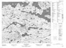
Maps showing White Hills Pond, Eagle River, Newfoundland and Labrador
White Hills Pond is a Lake located in Eagle River, Newfoundland and Labrador.
- Latitude: 53° 33' 2'' North (decimal: 53.5505555)
- Longitude: 56° 45' 34'' West (decimal: -56.7594444)
- Topography Feature Category: Lake
- Geographical Feature: Pond
- Canadian Province/Territory: Newfoundland and Labrador
- Location: Eagle River
- Atlas of Canada Locator Map: White Hills Pond
- GPS Coordinate Locator Map: White Hills Pond Lat/Long
White Hills Pond NTS Map Sheets