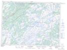
Maps showing Salmonier Nature Park, Newfoundland and Labrador
Salmonier Nature Park is a Conservation area located in Newfoundland and Labrador and has an elevation of 113 meters.
- Latitude: 47° 15' 34'' North (decimal: 47.2594443)
- Longitude: 53° 15' 15'' West (decimal: -53.2541666)
- Topography Feature Category: Conservation area
- Geographical Feature: Wildlife Refuge
- Canadian Province/Territory: Newfoundland and Labrador
- Elevation: 113 meters
- Atlas of Canada Locator Map: Salmonier Nature Park
- GPS Coordinate Locator Map: Salmonier Nature Park Lat/Long
Salmonier Nature Park NTS Map Sheets