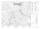
Maps showing South Round Pond, Eagle River, Newfoundland and Labrador
South Round Pond is a Lake located in Eagle River, Newfoundland and Labrador.
- Latitude: 53° 31' 17'' North (decimal: 53.5214267)
- Longitude: 57° 33' 12'' West (decimal: -57.5533804)
- Topography Feature Category: Lake
- Geographical Feature: Pond
- Canadian Province/Territory: Newfoundland and Labrador
- Location: Eagle River
- Atlas of Canada Locator Map: South Round Pond
- GPS Coordinate Locator Map: South Round Pond Lat/Long
South Round Pond NTS Map Sheets