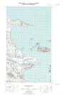
Maps showing Lance Cove, Eagle River, Newfoundland and Labrador
Lance Cove is a Bay located in Eagle River, Newfoundland and Labrador.
- Latitude: 53° 51' 53'' North (decimal: 53.8647082)
- Longitude: 57° 4' 29'' West (decimal: -57.0746870)
- Topography Feature Category: Bay
- Geographical Feature: Cove
- Canadian Province/Territory: Newfoundland and Labrador
- Location: Eagle River
- Atlas of Canada Locator Map: Lance Cove
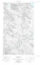
- GPS Coordinate Locator Map: Lance Cove Lat/Long
Lance Cove NTS Map Sheets