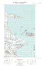
Maps showing Jackies Point, Eagle River, Newfoundland and Labrador
Jackies Point is a Cape located in Eagle River, Newfoundland and Labrador.
- Latitude: 53° 48' 27'' North (decimal: 53.8075505)
- Longitude: 57° 5' 33'' West (decimal: -57.0925237)
- Topography Feature Category: Cape
- Geographical Feature: Point
- Canadian Province/Territory: Newfoundland and Labrador
- Location: Eagle River
- Atlas of Canada Locator Map: Jackies Point
- GPS Coordinate Locator Map: Jackies Point Lat/Long
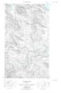
Jackies Point NTS Map Sheets