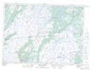
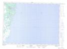
Maps showing Fermeuse, Newfoundland and Labrador
Fermeuse is a Town located in Newfoundland and Labrador and has an elevation of 35 meters.
- Latitude: 46° 58' 22'' North (decimal: 46.9727666)
- Longitude: 52° 58' 39'' West (decimal: -52.9774749)
- Topography Feature Category: Town
- Geographical Feature: Town
- Canadian Province/Territory: Newfoundland and Labrador
- Elevation: 35 meters
- Atlas of Canada Locator Map: Fermeuse
- GPS Coordinate Locator Map: Fermeuse Lat/Long
Fermeuse NTS Map Sheets