Maps showing Kings Cove, Newfoundland and Labrador
Kings Cove is a Lake located in Newfoundland and Labrador.
- Latitude: 50° 36' 46'' North (decimal: 50.6129098)
- Longitude: 57° 20' 30'' West (decimal: -57.3415300)
- Topography Feature Category: Lake
- Geographical Feature: Pond
- Canadian Province/Territory: Newfoundland and Labrador
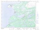
- Atlas of Canada Locator Map: Kings Cove
- GPS Coordinate Locator Map: Kings Cove Lat/Long
Kings Cove NTS Map Sheets