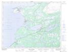
Maps showing Mark Point, Newfoundland and Labrador
Mark Point is a Cape located in Newfoundland and Labrador.
- Latitude: 50° 38' 41'' North (decimal: 50.6448399)
- Longitude: 57° 16' 9'' West (decimal: -57.2692298)
- Topography Feature Category: Cape
- Geographical Feature: Point
- Canadian Province/Territory: Newfoundland and Labrador
- Atlas of Canada Locator Map: Mark Point
- GPS Coordinate Locator Map: Mark Point Lat/Long
Mark Point NTS Map Sheets