Maps showing Main Part Brook, Newfoundland and Labrador
Main Part Brook is a River located in Newfoundland and Labrador.
- Latitude: 50° 28' 2'' North (decimal: 50.4672799)
- Longitude: 57° 1' 58'' West (decimal: -57.0326899)
- Topography Feature Category: River
- Geographical Feature: Brook
- Canadian Province/Territory: Newfoundland and Labrador
- Atlas of Canada Locator Map: Main Part Brook
- GPS Coordinate Locator Map: Main Part Brook Lat/Long
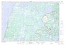
Main Part Brook NTS Map Sheets