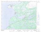
Maps showing Arctic Mesh, Newfoundland and Labrador
Arctic Mesh is a Low vegetation located in Newfoundland and Labrador.
- Latitude: 50° 35' 9'' North (decimal: 50.5858200)
- Longitude: 57° 17' 6'' West (decimal: -57.2848800)
- Topography Feature Category: Low vegetation
- Geographical Feature: Marsh
- Canadian Province/Territory: Newfoundland and Labrador
- Atlas of Canada Locator Map: Arctic Mesh
- GPS Coordinate Locator Map: Arctic Mesh Lat/Long
Arctic Mesh NTS Map Sheets