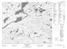
Maps showing Sandy Hill Brook, Newfoundland and Labrador
Sandy Hill Brook is a River located in Newfoundland and Labrador.
- Latitude: 53° 22' 59'' North (decimal: 53.3830199)
- Longitude: 57° 20' 13'' West (decimal: -57.3370000)
- Topography Feature Category: River
- Geographical Feature: Brook
- Canadian Province/Territory: Newfoundland and Labrador
- Atlas of Canada Locator Map: Sandy Hill Brook
- GPS Coordinate Locator Map: Sandy Hill Brook Lat/Long
Sandy Hill Brook NTS Map Sheets