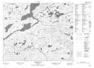
Maps showing Stalk Hill Ponds, Newfoundland and Labrador
Stalk Hill Ponds is a Lake located in Newfoundland and Labrador.
- Latitude: 53° 26' 55'' North (decimal: 53.4485699)
- Longitude: 57° 15' 27'' West (decimal: -57.2575198)
- Topography Feature Category: Lake
- Geographical Feature: Ponds
- Canadian Province/Territory: Newfoundland and Labrador
- Atlas of Canada Locator Map: Stalk Hill Ponds
- GPS Coordinate Locator Map: Stalk Hill Ponds Lat/Long
Stalk Hill Ponds NTS Map Sheets