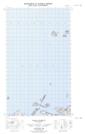
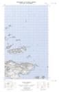
Maps showing Light House (Hill), Newfoundland and Labrador
Light House (Hill) is a Mountain located in Newfoundland and Labrador.
- Latitude: 53° 51' 21'' North (decimal: 53.8558798)
- Longitude: 56° 58' 56'' West (decimal: -56.9821300)
- Topography Feature Category: Mountain
- Geographical Feature: Hill
- Canadian Province/Territory: Newfoundland and Labrador
- Atlas of Canada Locator Map: Light House (Hill)
- GPS Coordinate Locator Map: Light House (Hill) Lat/Long
Light House (Hill) NTS Map Sheets