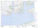
Maps showing Carolines Ballast Rubble, Newfoundland and Labrador
Carolines Ballast Rubble is a Cape located in Newfoundland and Labrador.
- Latitude: 47° 37' 34'' North (decimal: 47.6259798)
- Longitude: 56° 1' 37'' West (decimal: -56.0270398)
- Topography Feature Category: Cape
- Geographical Feature: Point
- Canadian Province/Territory: Newfoundland and Labrador
- Atlas of Canada Locator Map: Carolines Ballast Rubble
- GPS Coordinate Locator Map: Carolines Ballast Rubble Lat/Long