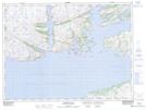
Maps showing Winter House Cove Pond, Newfoundland and Labrador
Winter House Cove Pond is a Lake located in Newfoundland and Labrador.
- Latitude: 47° 37' 26'' North (decimal: 47.6237900)
- Longitude: 56° 1' 4'' West (decimal: -56.0177400)
- Topography Feature Category: Lake
- Geographical Feature: Pond
- Canadian Province/Territory: Newfoundland and Labrador
- Atlas of Canada Locator Map: Winter House Cove Pond
- GPS Coordinate Locator Map: Winter House Cove Pond Lat/Long