Maps showing Katesis Feeder Pond, Newfoundland and Labrador
Katesis Feeder Pond is a Lake located in Newfoundland and Labrador.
- Latitude: 50° 27' 29'' North (decimal: 50.4580398)
- Longitude: 57° 20' 27'' West (decimal: -57.3409100)
- Topography Feature Category: Lake
- Geographical Feature: Pond
- Canadian Province/Territory: Newfoundland and Labrador
- Atlas of Canada Locator Map: Katesis Feeder Pond
- GPS Coordinate Locator Map: Katesis Feeder Pond Lat/Long
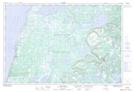
Katesis Feeder Pond NTS Map Sheets