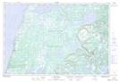
Maps showing Long Marsh Pond, Newfoundland and Labrador
Long Marsh Pond is a Lake located in Newfoundland and Labrador.
- Latitude: 50° 29' 55'' North (decimal: 50.4987398)
- Longitude: 57° 26' 18'' West (decimal: -57.4383699)
- Topography Feature Category: Lake
- Geographical Feature: Pond
- Canadian Province/Territory: Newfoundland and Labrador
- Atlas of Canada Locator Map: Long Marsh Pond
- GPS Coordinate Locator Map: Long Marsh Pond Lat/Long
Long Marsh Pond NTS Map Sheets