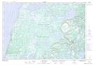
Maps showing Horseshoe, Newfoundland and Labrador
Horseshoe is a Lake located in Newfoundland and Labrador.
- Latitude: 50° 19' 18'' North (decimal: 50.3216099)
- Longitude: 57° 6' 37'' West (decimal: -57.1103099)
- Topography Feature Category: Lake
- Geographical Feature: Pond
- Canadian Province/Territory: Newfoundland and Labrador
- Atlas of Canada Locator Map: Horseshoe
- GPS Coordinate Locator Map: Horseshoe Lat/Long
Horseshoe NTS Map Sheets