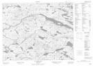
Maps showing Mangrove Big Pond, Newfoundland and Labrador
Mangrove Big Pond is a Lake located in Newfoundland and Labrador.
- Latitude: 52° 26' 45'' North (decimal: 52.4459399)
- Longitude: 56° 3' 9'' West (decimal: -56.0524898)
- Topography Feature Category: Lake
- Geographical Feature: Pond
- Canadian Province/Territory: Newfoundland and Labrador
- Atlas of Canada Locator Map: Mangrove Big Pond
- GPS Coordinate Locator Map: Mangrove Big Pond Lat/Long
Mangrove Big Pond NTS Map Sheets