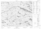
Maps showing Marys Harbour First Pond, Newfoundland and Labrador
Marys Harbour First Pond is a Lake located in Newfoundland and Labrador.
- Latitude: 52° 19' 5'' North (decimal: 52.3179200)
- Longitude: 56° 1' 41'' West (decimal: -56.0281700)
- Topography Feature Category: Lake
- Geographical Feature: Pond
- Canadian Province/Territory: Newfoundland and Labrador
- Atlas of Canada Locator Map: Marys Harbour First Pond
- GPS Coordinate Locator Map: Marys Harbour First Pond Lat/Long
Marys Harbour First Pond NTS Map Sheets